Waterfalls in Pisgah Forest and Dupont State Forest
- - - - - - - - - - - - - - - - - - - - - - - - - - - - - - -
 Bridal Veil Falls
Bridal Veil Falls
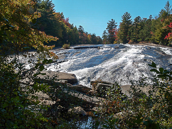
Bridal Veil Falls in located in Dupont State Forest. To get to the falls it is about a 3 mile hike one way on gravel roads beginning at the Buck Forest parking areas. The falls travels over a wide section of bedrock. The falls is about 10 feet high.
DuPont State Recreational Forest Hours: 5:00a - 10:00p
- - - - - - - - - - - - - - - - - - - - - - - - - - - - - - -
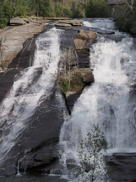
Triple Falls consists of three distinct cascades totalling about 120′ in vertical drop. Featured in the movie Last of the Mohicans and The Hunger Games, Triple Falls is about a seven minute walk from the Hooker Falls parking area.
To see this 120-foot tall waterfall, hike one mile roundtrip from the Hooker Falls parking area or 2.2 miles roundtrip from the High Falls parking area.
For a closer view of the falls go just past the overlook and you will see a trail that forks off to the left and heads down via a big staircase to a large rock below the top two falls and atop of the third falls. But no swimming or wading is allowed due to currents. And climbing rock faces is prohibited since it's very dangerous.
A picnic shelter is located near the falls trail. Pack a lunch and enjoy the view of the falls while eating or just snacking.
DuPont State Recreational Forest Hours: 5:00a - 10:00p
- - - - - - - - - - - - - - - - - - - - - - - - - - - - - - -
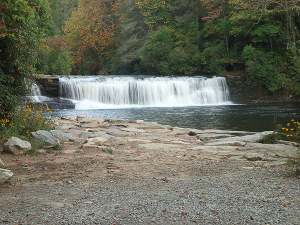
Hooker Falls is a beautiful waterfalls that is about 15 feet high located in Dupont State Forest. It is an easy short walk (1/4 mile) from the parking lot to the falls. You will first come to an observation deck at the top of the falls. Then continue down hill on the trail to the basin of the falls. This is the only waterfall in DuPont State Forest that is safe for swimming and is very popular. You can also kayak from Cascade Lake up to the waterfall. Bring the family and have a picnic and swim in the basin of the falls.
Hooker Falls is a beautiful waterfalls that is about 15 feet high located in Dupont Forest. It is an easy .25 hike from the parking on a gravel road. Bring the family and have a picnic and swim in the basin of the falls.
There is a observation area above the falls, and you can continue on the trail to reach the base of the falls.
From Hooker Falls you can hike one mile to Triple Falls and 1.5 miles to High Falls.
There are porta johns at the parking area at Hooker Falls.
DuPont State Recreational Forest Hours: 5:00a - 10:00p
- - - - - - - - - - - - - - - - - - - - - - - - - - - - - - -
 Looking Glass Falls
Looking Glass Falls
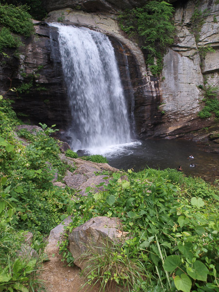
Looking Glass Falls is located on Hwy 276 in Pisgah National Forest. Looking Glass Falls is 60 feet high and is easy accessible. The waterfall can be seen from the highway or you can desend the steps to the bottom of the falls. You can venture over the rocks (but be careful for the wet rocks, they can be slippery). You can also wade in the water especially on a hot day.
- - - - - - - - - - - - - - - - - - - - - - - - - - - - - - -
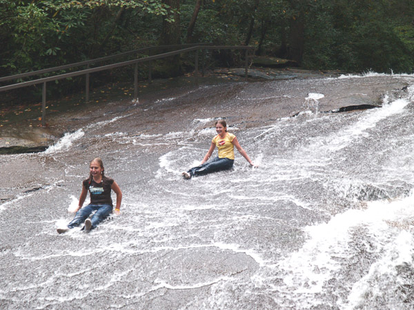 Sliding Rock
Sliding Rock
 Sliding Rock
Sliding Rock
Pisgah Forest, NC 28768
Sliding Rock is located in the PIsgah National Forest near Brevard. Sliding Rock is approximately 7.5 miles from the junction of US Hwy 64 and 276. Sliding Rock will be on your left. You will go pass Looking Glass Falls on the right. Take a plunge down the 60 foot slippery cascade into the 50-60 degree, 8 foot deep pool.
- - - - - - - - - - - - - - - - - - - - - - - - - - - - - - -
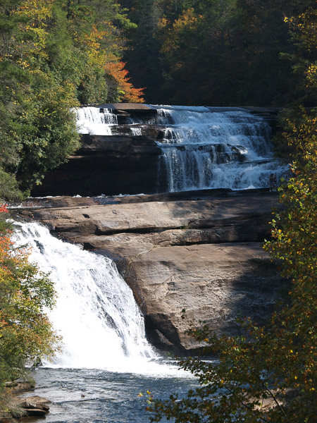 Triple Falls
Triple Falls
Triple Falls consists of three distinct cascades totalling about 120′ in vertical drop. Featured in the movie Last of the Mohicans and The Hunger Games, Triple Falls is about a seven minute walk from the Hooker Falls parking area.
To see this 120-foot tall waterfall, hike one mile roundtrip from the Hooker Falls parking area or 2.2 miles roundtrip from the High Falls parking area.
A picnic shelter is located near the falls trail. Pack a lunch and enjoy the view of the falls while eating or just snacking.
DuPont State Recreational Forest Hours: 5:00a - 10:00p
- - - - - - - - - - - - - - - - - - - - - - - - - - - - - - -
Directions for Waterfalls
Heading Northeast
| Destination | Mileage | Time | Route |
|---|---|---|---|
| Linville Falls | 59 | 1.1 | Milepost 316 on Blue Ridge Parkway |
| Crabtree Falls | 55 | 1.3 | Milepost 339 on Blue Ridge Parkway |
Heading Southeast
| Destination | Mileage | Time | Route |
|---|---|---|---|
| Hickory Nut Falls | 27.8 | 1.0 |
In Chimney Rock Park |
Heading Southwest
| Destination | Mileage | Time | Route |
|---|---|---|---|
| Looking Glass Falls | 36 | 0.7 | via NC-280 E and I-26 W |
| Moore Cove Falls | 37 | 0.8 | via NC-280 E and I-26 W |
| Sliding Rock | 38 | 0.8 | via NC-280 E and I-26 W |
| Daniel Ridge Falls | 39 | 0.8 | 2.5 miles past Pisgah Wildlife Educational Center |
| Skinny Dip Falls | 44 | 1.3 | Milepost 417 Blue Ridge Parkway |
| High Falls | 42 | 1.3 | In Dupont State Forest |
| Triple Falls | 42 | 1.3 | In Dupont State Forest |
| Hooker Falls | 42 | 1.3 | In Dupont State Forest |
| Pearson Falls | 37.0 | 0.8 | In Saluda, NC |
| Rainbow Falls | 49.0 | 1.4 | In Gorges State Park NC |
| Turtleback Falls | 49.0 | 1.4 | In Gorges State NC |
| Upper Whitewater Falls | 61 | 1.5 | US 64 towards Highland |
| Whitewater Falls | 61 | 1.5 | US 64 towards Highland |
| Dry Falls | 74 | 1.7 | US 64W |
| Glenn Falls | 75.3 | 1.8 | On Highlands |
Heading West
| Destination | Mileage | Time | Route |
|---|---|---|---|
| Soco Falls | 40.6 | 0.8 | NC-19, 16.6 miles past Clyde, NC |
| Mingo Falls | 69.0 | 1.2 |
In Cherokee Indian Reservation NC |
| Deep Creek Falls | 66.2 | 1.3 | US-74 near Whitter, NC |
| Tom Branch Falls | 69.0 | 1.2 |
In Cherokee Indian Reservation NC |
| Juney Whank Falls | 69.0 | 1.2 | InCherokee Indian Reservation NC |
| Indian Creek Falls | 69.0 | 1.2 | In Cherokee Indian Reservation NC |
Note: Routes are for general information and not to be used as a sole means of navigation.
